Restaurant nearby SUBWAY®
Romania
Restaurant nearby SUBWAY®
SUBWAY®
Blejoi Rumænien
contacts phone
:
+40
Latitude:
44.9679415
, Longitude:
25.9627922
read more
nearest Restaurant
64 m
Motel/Restaurant Km6
Blejoi
Restaurant
read more
158 m
D&D Bistro
107070, DN1, Blejoi
Restaurant
read more
307 m
Restaurant Turcesc
Păulești
Restaurant
read more
634 m
Choco Kebab Ploiești Shopping City
Unnamed Road, Blejoi
Restaurant
read more
860 m
Los Tacos
shopping city, Ploiești
Restaurant
read more
940 m
Mesopotamia
km 6 shopping city, DN1B, Ploiești
Restaurant
read more
970 m
Pizza Hut
Blejoi
Restaurant
read more
997 m
KFC
Ploiești Shopping City, DN1B Km. 6, Blejoi
Restaurant
read more
997 m
Kentucky Fried Chicken
Ploiești Shopping City, DN1B Km. 6, Blejoi
Restaurant
read more
1.001 km
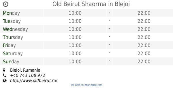
Old Beirut Shaorma
Blejoi
Restaurant
read more
1.148 km
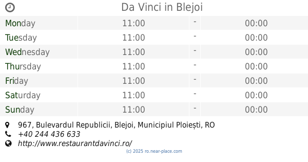
Da Vinci
Bulevardul Republicii 967, Blejoi
Restaurant
read more
1.174 km
SICCOM GRUP SRL
Blejoi
Restaurant
read more
1.478 km
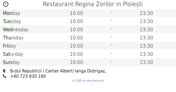
Restaurant Regina Zorilor
B-dul Republicii ( Cartier Albert) langa Distrigaz, Ploiești
Restaurant
read more
1.48 km
Regina Noptii
Bulevardul Republicii 1, Ploiești
Restaurant
read more
1.61 km
Cristal Restaurant & Pub
Bulevardul Republicii 329, Ploiești
Restaurant
read more
1.61 km
Restaurant&Pub Cristal
Bulevardul Republicii 329, Ploiești
Restaurant
read more
1.635 km
Akua Garden
Bulevardul Republicii 339, Ploiești
Restaurant
read more
1.702 km
Yarus Restaurant
Bulevardul Republicii, Ploiești
Restaurant
read more
1.8 km
Dim Sum
Bulevardul Republicii 327, Ploiești
Restaurant
read more
1.946 km
Larry Restaurant
Strada Lotrului 2, Ploiești
Restaurant
read more
2.097 km
The House Of Ribs
Bulevardul Republicii 307, Ploiești
Restaurant
read more
2.097 km
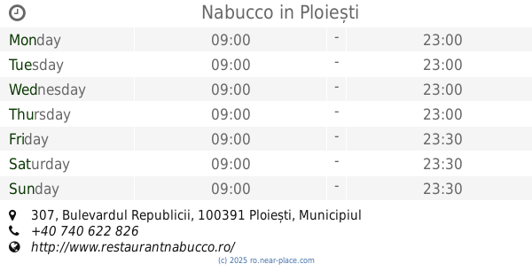
Nabucco
Bulevardul Republicii 307, Ploiești
Restaurant
read more
2.332 km
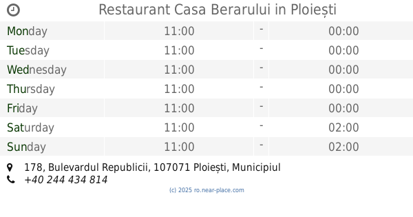
Restaurant Casa Berarului
Bulevardul Republicii 178, Ploiești
Restaurant
read more
2.401 km
Sky Restaurant
Str. Principala, nr. 1, Păuleștii Noi
Restaurant
read more
2.426 km
Sky Lounge
DJ102, Păuleștii Noi
Restaurant
read more
📑
all categories
Accounting
Administrative area level 1
Administrative area level 2
Airport
Amusement park
Aquarium
Art gallery
Atm
Bakery
Bank
Bar
Beauty salon
Bicycle store
Book store
Bowling alley
Bus station
Cafe
Campground
Car dealer
Car rental
Car repair
Car wash
Casino
Cemetery
Church
City hall
Clothing store
Colloquial area
Convenience store
Country
Courthouse
Dentist
Department store
Doctor
Electrician
Electronics store
Embassy
Finance
Fire station
Florist
Food
Funeral home
Furniture store
Gas station
General contractor
Grocery or supermarket
Gym
Hair care
Hardware store
Health
Home goods store
Hospital
Insurance agency
Jewelry store
Laundry
Lawyer
Library
Light rail station
Liquor store
Local government office
Locality
Locksmith
Lodging
Meal delivery
Meal takeaway
Mosque
Movie rental
Movie theater
Moving company
Museum
Natural feature
Neighborhood
Night club
Painter
Park
Parking
Pet store
Pharmacy
Physiotherapist
Place of worship
Plumber
Point of interest
Police
Political
Post office
Premise
Real estate agency
Restaurant
Roofing contractor
Route
Rv park, camping
School
Shoe store
Shopping mall
Spa
Stadium
Storage
Store
Subpremise
Subway station
Supermarket
Synagogue
Taxi stand
Train station
Transit station
Travel agency
University
Veterinary care
Zoo
administrative area level 3
sublocality level 1
sublocality level 2
↑