Park nearby Parcul Cosmos
Coronavirus disease (COVID-19) Situation
confirmed cases
3529735
deaths
68929
Romania
Park nearby Parcul Cosmos
Parcul Cosmos
Șoseaua Pantelimon, București Rumania
contacts phone
:
+40
Latitude:
44.440712
, Longitude:
26.1841794
read more
nearest Park
43 m
Parcul Cosmos
Sector 2
Park
read more
184 m
Parc
Șoseaua Pantelimon 362, București
Park
read more
660 m
Parcul Ecologic Dobroeşti
Strada Aurului 12, București
Park
read more
660 m
Ecological Park Dobroeşti
Strada Aurului 12, București
Park
read more
687 m
Parc Almașul Marcu
Sector 2
Park
read more
691 m
Parcul Sticlăriei
Strada Ion Șahighian, București
Park
read more
1.078 km
Parcul Morarilor
Lacul Morarilor, București
Park
read more
1.286 km
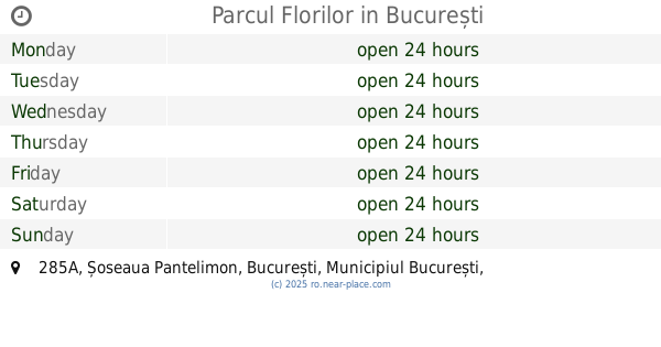
Parcul Florilor
Șoseaua Pantelimon 285A, București
Park
read more
1.424 km
Pantelimon Park
Șoseaua Gării Cățelu, București
Park
read more
1.424 km
Parcul Pantelimon
Șoseaua Gării Cățelu, București
Park
read more
1.555 km
Parcul Pantelimon
Sector 2
Park
read more
1.753 km
Minis Park
Aleea Solidarității 1, București
Park
read more
1.753 km
Parc Minis
Aleea Solidarității 1, București
Park
read more
1.835 km
Parcul Sf. Pantelimon
Strada Ciocârliei 18, București
Park
read more
1.884 km
Spațiu de joacă
Titan, București
Park
read more
1.884 km
Spațiu de joacă
Titan, Bucharest
Park
read more
1.913 km
Constantin Brâncuşi Park
Strada Constantin Brâncuși, București
Park
read more
1.913 km
Parcul Constantin Brâncuși
Strada Constantin Brâncuși, București
Park
read more
1.921 km
Parc public
Aleea Budacu, București
Park
read more
1.971 km
Parc Brâncuşi
Titan, Bucharest
Park
read more
1.971 km
Parc Brâncuşi
Titan, București
Park
read more
2.035 km
Parcul Delfinului
Aleea Dobrina, București
Park
read more
2.072 km
Parcul Ostrov
Sector 2
Park
read more
2.765 km
Parcul Codrii Neamţului
Sector 3
Park
read more
3.129 km
Rosarium
Strada Câmpia Libertății, București
Park
read more
📑
all categories
Accounting
Administrative area level 1
Administrative area level 2
Airport
Amusement park
Aquarium
Art gallery
Atm
Bakery
Bank
Bar
Beauty salon
Bicycle store
Book store
Bowling alley
Bus station
Cafe
Campground
Car dealer
Car rental
Car repair
Car wash
Casino
Cemetery
Church
City hall
Clothing store
Colloquial area
Convenience store
Country
Courthouse
Dentist
Department store
Doctor
Electrician
Electronics store
Embassy
Finance
Fire station
Florist
Food
Funeral home
Furniture store
Gas station
General contractor
Grocery or supermarket
Gym
Hair care
Hardware store
Health
Home goods store
Hospital
Insurance agency
Jewelry store
Laundry
Lawyer
Library
Light rail station
Liquor store
Local government office
Locality
Locksmith
Lodging
Meal delivery
Meal takeaway
Mosque
Movie rental
Movie theater
Moving company
Museum
Natural feature
Neighborhood
Night club
Painter
Park
Parking
Pet store
Pharmacy
Physiotherapist
Place of worship
Plumber
Point of interest
Police
Political
Post office
Premise
Real estate agency
Restaurant
Roofing contractor
Route
Rv park, camping
School
Shoe store
Shopping mall
Spa
Stadium
Storage
Store
Subpremise
Subway station
Supermarket
Synagogue
Taxi stand
Train station
Transit station
Travel agency
University
Veterinary care
Zoo
administrative area level 3
sublocality level 1
sublocality level 2
↑