Gas station nearby Rompetrol
Romania
Gas station nearby Rompetrol
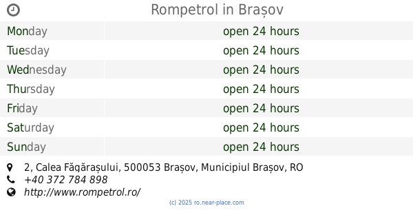
Rompetrol
Strada Rozelor, Brașov Rumania
contacts phone
:
+40
Latitude:
45.6604
, Longitude:
25.6259
read more
nearest Gas station
705 m
Lukoil
Bulevardul Alexandru Vlahuță 30, Brașov
Gas station
read more
813 m
OMV
Bulevardul Gării 7A, Brașov
Gas station
read more
813 m
Statie de distributie carburanti OMV
Bulevardul Gării 7A, Brașov
Gas station
read more
942 m
SOCAR
Strada Hărmanului 52, Brașov
Gas station
read more
1.069 km
Rompetrol Statie Gpl
Tractorul, Brașov
Gas station
read more
1.748 km
Crimbo Gas
Brașov
Gas station
read more
1.779 km
Lukoil
Strada Hărmanului 49X, Brașov
Gas station
read more
1.848 km
Rompetrol
Strada 13 Decembrie 94, Brașov
Gas station
read more
1.922 km
Petrom
Strada Nicolae Titulescu nr. 2, Lehliu
Gas station
read more
1.922 km
Statie de distributie carburanti PETROM
Strada Nicolae Titulescu nr. 2, Lehliu
Gas station
read more
2.006 km
OMV
Strada 13 Decembrie 1-3, Brașov
Gas station
read more
2.057 km
Statie de distributie carburanti PETROM
Strada Hărmanului nr. 55, Brașov
Gas station
read more
2.057 km
Petrom
Strada Hărmanului nr. 55, Brașov
Gas station
read more
2.412 km
Petrom
Strada Temeliei nr. 1, Brașov
Gas station
read more
2.412 km
Petrom
nr. 1, Strada Temeliei, Brașov
Gas station
read more
2.412 km
Statie de distributie carburanti PETROM
nr. 1, Strada Temeliei, Brașov
Gas station
read more
2.479 km
DIESELpoint Access
Str. Zizinului Nr.125, Brașov
Gas station
read more
2.504 km
Lukoil
Strada Zizinului 144A, Brașov
Gas station
read more
3.033 km
Lukoil
Strada Poienelor 4, Brașov
Gas station
read more
3.052 km
Independent Brasov
Bulevardul Griviței 1Y, Brașov
Gas station
read more
3.07 km
MOL
Calea București 101, Brașov
Gas station
read more
3.1 km
Petrom
Astra, Brașov
Gas station
read more
3.238 km
Lukoil
Strada Hărmanului 77, Brașov
Gas station
read more
4.031 km
Rompetrol
Calea Făgărașului 2, Brașov
Gas station
read more
4.251 km
Petrom
Calea Făgărașului nr. 8, Brașov
Gas station
read more
📑
all categories
Accounting
Administrative area level 1
Administrative area level 2
Airport
Amusement park
Aquarium
Art gallery
Atm
Bakery
Bank
Bar
Beauty salon
Bicycle store
Book store
Bowling alley
Bus station
Cafe
Campground
Car dealer
Car rental
Car repair
Car wash
Casino
Cemetery
Church
City hall
Clothing store
Colloquial area
Convenience store
Country
Courthouse
Dentist
Department store
Doctor
Electrician
Electronics store
Embassy
Finance
Fire station
Florist
Food
Funeral home
Furniture store
Gas station
General contractor
Grocery or supermarket
Gym
Hair care
Hardware store
Health
Home goods store
Hospital
Insurance agency
Jewelry store
Laundry
Lawyer
Library
Light rail station
Liquor store
Local government office
Locality
Locksmith
Lodging
Meal delivery
Meal takeaway
Mosque
Movie rental
Movie theater
Moving company
Museum
Natural feature
Neighborhood
Night club
Painter
Park
Parking
Pet store
Pharmacy
Physiotherapist
Place of worship
Plumber
Point of interest
Police
Political
Post office
Premise
Real estate agency
Restaurant
Roofing contractor
Route
Rv park, camping
School
Shoe store
Shopping mall
Spa
Stadium
Storage
Store
Subpremise
Subway station
Supermarket
Synagogue
Taxi stand
Train station
Transit station
Travel agency
University
Veterinary care
Zoo
administrative area level 3
sublocality level 1
sublocality level 2
↑