Bar nearby Cafe Bar Narcisa
Romania
Bar nearby Cafe Bar Narcisa
Cafe Bar Narcisa
Strada Dreptății, Botoșani Rumania
contacts phone
:
+40
Latitude:
47.7490682
, Longitude:
26.6655303
read more
nearest Bar
484 m
Casablanca
Strada Ștefan Luchian 36, Botoșani
Bar
read more
557 m
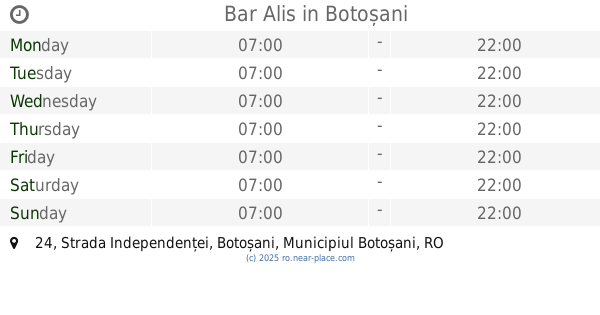
Bar Alis
Strada Independenței 24, Botoșani
Bar
read more
576 m
Mon Cafe
Piața Revoluției 13, Botoșani
Bar
read more
777 m
Grand Irish Pub
Strada Marchian 5, Botoșani
Bar
read more
794 m
Pub Panda
Casa Bolfosu, Strada Ion Pilat 5, Botoșani
Bar
read more
886 m
La Căruța
Strada Teatrului, Botoșani
Bar
read more
900 m
Cafe Bar Royal Alex-Lucas
Strada Teatrului, Botoșani
Bar
read more
900 m
Cafe Bar Alex-Lucas Royal
Strada Teatrului, Botoșani
Bar
read more
1.052 km
Society Pub
Bulevardul Mihai Eminescu, Botoșani
Bar
read more
1.062 km
Go Bet
Bulevardul Mihai Eminescu 8, Botoșani
Bar
read more
1.082 km
Galaxy
Bulevardul Mihai Eminescu, Botoșani
Bar
read more
1.095 km
FastFood&Pizza
Calea Națională 82, Botoșani
Bar
read more
1.108 km
Crema Rooms
Aleea Zorilor 13, Botoșani
Bar
read more
1.116 km
Enjoy Pub
Bulevardul Mihai Eminescu 48, Botoșani
Bar
read more
1.195 km
Boutique Caffe Sport Bets
Botoșani
Bar
read more
1.234 km
Stuf
Bulevardul Mihai Eminescu, Botoșani
Bar
read more
1.37 km
Barul vesel
Strada Uzinei 2, Botoșani
Bar
read more
1.46 km
Bar Ama
Bulevardul George Enescu 16, Botoșani
Bar
read more
1.529 km
BiersTube
Strada Primăverii 22, Botoșani
Bar
read more
1.597 km
Bibicu
Strada Primăverii 8, Botoșani
Bar
read more
1.604 km
Chicago 3
Bulevardul George Enescu 22, Botoșani
Bar
read more
1.669 km
Cafe - bar Brenda
Aleea Curcubeului 11, Botoșani
Bar
read more
1.721 km
TRANS CVM
Casa Memorială Nicolae Iorga, Strada Nicolae Iorga 14, Botoșani
Bar
read more
2.07 km
Barul lui Gică
Strada Ion Creangă 66, Botoșani
Bar
read more
2.07 km
Gica's Bar
Strada Ion Creangă 66, Botoșani
Bar
read more
📑
all categories
Accounting
Administrative area level 1
Administrative area level 2
Airport
Amusement park
Aquarium
Art gallery
Atm
Bakery
Bank
Bar
Beauty salon
Bicycle store
Book store
Bowling alley
Bus station
Cafe
Campground
Car dealer
Car rental
Car repair
Car wash
Casino
Cemetery
Church
City hall
Clothing store
Colloquial area
Convenience store
Country
Courthouse
Dentist
Department store
Doctor
Electrician
Electronics store
Embassy
Finance
Fire station
Florist
Food
Funeral home
Furniture store
Gas station
General contractor
Grocery or supermarket
Gym
Hair care
Hardware store
Health
Home goods store
Hospital
Insurance agency
Jewelry store
Laundry
Lawyer
Library
Light rail station
Liquor store
Local government office
Locality
Locksmith
Lodging
Meal delivery
Meal takeaway
Mosque
Movie rental
Movie theater
Moving company
Museum
Natural feature
Neighborhood
Night club
Painter
Park
Parking
Pet store
Pharmacy
Physiotherapist
Place of worship
Plumber
Point of interest
Police
Political
Post office
Premise
Real estate agency
Restaurant
Roofing contractor
Route
Rv park, camping
School
Shoe store
Shopping mall
Spa
Stadium
Storage
Store
Subpremise
Subway station
Supermarket
Synagogue
Taxi stand
Train station
Transit station
Travel agency
University
Veterinary care
Zoo
administrative area level 3
sublocality level 1
sublocality level 2
↑